Etymology
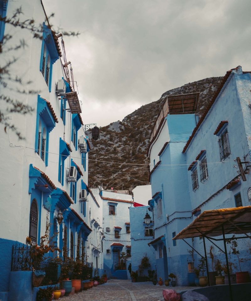
The name “Chefchaouen” is of origin, derived from the word isakon or echaouen which means ‘the horns’, and the word chef which means ‘look at’. Chefchaouen thus means ‘look at the horns’, reflecting the two mountain peaks overlooking the area. Nowadays, Chefchaouen is known as “the Blue Pearl” of Morocco, known for its traditional houses painted in blue and white.
The city is also called “Chaouen” by the inhabitants of the northern region.
History
The city was founded in 1471 as a small by , a descendant of and . Al-Alami built the kasbah to defend against . Along with the of the region, many and settled here during and after the of Spain.
Ali Ben Rashid was born in Gherzoim, a nearby village, c. 1440 (844 AH). He went to in 1460, and achieved outstanding services in battle against the Crusaders. He settled in Chefchaouen c. 1465 and, due to his experience as a warrior, was chosen as successor to his cousin ibn Abi Jum’ah and leader of the in the northwest of . He fought alongside the of , , who married his daughter, the Mujahida . The latter, known by her title, , reigned Chefchaouen through a rapid period of growth and development.
Chefchaouen was home to families between 1492 and 1609, when the last were expelled from by . These Andalusian families built their own residential quarters surrounded by walls, in the Andalusian architectural style, very similar to the Arab quarters of Granada.
Pressures of the Reconquista and the fall of Granada led many of its peoples to immigrate to Morocco, which continued for more than three centuries. Some of them chose the large cities of Fes, Marrakesh, Tlemcen, Tunis, and , while others settled in the jihadist fortress of Chefchaouen, which was in a fierce war against Portuguese armies. They established their quarters on the rugged slopes of the Chefchaouen Mountains. In a few decades, the fortress of Chefchaouen turned into a prosperous new city, in which the Andalusi-Granadan culture merged with the culture of Ghomara. The urban expansion included military fortifications such as walls and about ten gates and the construction of a number of mosques including the . The Andalusian community that settled in the city also included a number of well-known poets and philosophers.
In October 1920, General occupied the city for the . Following the Spanish [], Chaouen was part of the led by from 1924 to 1926. In September 1925, in the middle of the , a rogue squadron of American volunteer pilots, the , . Colonel had proposed the idea to French Prime Minister , who “warmly welcomed the Colonel’s request.”
After el-Krim was defeated with the help of the French, he was deported to . The Spanish Army retook the city in 1926.
Geography Location
The city of Chefchaouen is located at about 600 metres (2,000 ft) above sea level in the foothills of the mountain in the western part of the mountain range, in northwestern Morocco. The is among the largest in Morocco, with an area of 3,443 km (1,329 sq mi). It is bordered by five provinces – to the northwest, to the west, to the east, to the south, to the southwest – and the Mediterranean Sea to the northeast. The Province of Chefchaouen belongs to the Region and consists of one urban commune (the municipality of Chefchaouen) and 27 rural communes, giving the province a rural character.
Landmarks
Chefchaouen’s blue walls are a popular subject of interest. There are several theories as to why the walls were painted blue. One popular theory is that the blue keeps away. The blue is said to symbolize the sky and heaven, and serve as a reminder to lead a spiritual life. However, according to some locals, the walls were mandated to be painted blue in the 1970s in order to attract tourists.
Medina
The medina is one of the most important historical neighborhoods, where blue and white paint dominates the walls and houses, and the streets are so narrow that cars cannot pass, which provides a peaceful and calm atmosphere.
The kasbah is one of the first buildings constructed in the city in the Andalusian style. It includes the emir’s residence, a small mosque for the emir, a prison, a garden, a horse stable, sheds for the animals and dozens of towers. The kasbah played a major role as a house of Makhzen (i.e. authoritarian forces) until its occupation by the Spanish in 1920. The kasbah was built from strong and sustainable local raw materials such as limestone, with successive layers of hard . Fired red bricks were used to build the sides of the doors and arches. Local cedar, fir, juniper and other woods were used to form the roofs, clad in red tiles. The Kasbah overlooks the Outae Hammam yard.
The biggest courtyard of the old Medina is Outae Hammam at more than 4,000 m (43,000 sq ft). Its name is derived from outae which means “low ground or yard” and hammam due to the presence of the first hammam (traditional public bath) in the center of the town. Its design is similar to the Andalusian public yards of Granada or . While historically a crossroad, its function changed to a tourist center surrounded by cafes and restaurants.
Souiqah quarter is the second-oldest residential agglomeration in the city, and includes the houses of old Andalusian families and a large number of shops and stalls that sell local products.
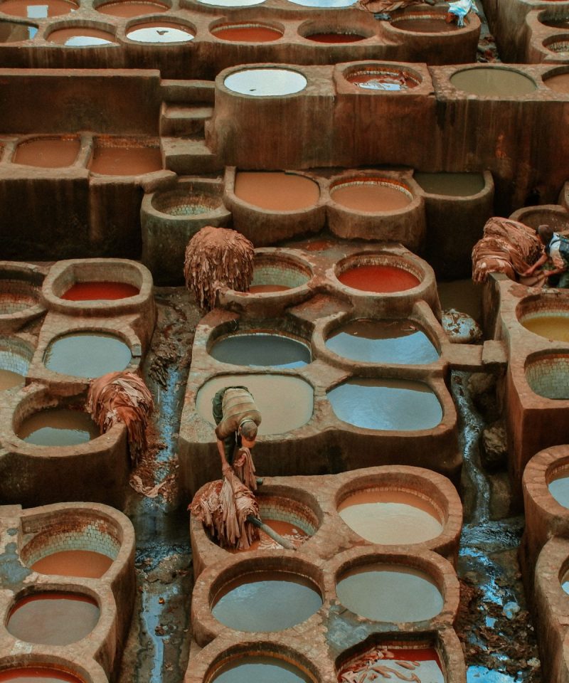
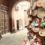
The traditional (bazaar, marketplace) has small shops and stalls selling traditional handiwork such as colorful porcelain utensils, textiles and clothing, leatherware and various souvenirs. The weekly market was a place for strengthening social ties between the townspeople and their rural environment.
Al-Kharazin district was settled by many villagers from neighboring tribes, giving it a rural character.
Religious sites
The is the city’s oldest and historically most important mosque, located at Place Outae Hammam at the heart of the medina, close to the kasbah. The Spanish Mosque is a disused mosque overlooking the town from a hill to the east. It was built by the Spanish in the 1920s, and is now a popular lookout point. The Mausoleum of Abdessalam Ben Mshish al-Alami is dedicated to the patron saint of northern Morocco’s Jebalah region, Moulay . His tomb and the village surrounding it is roughly 50 kilometres (31 mi) northwest of Chefchaouen on the old road to .
Natural areas
Ras Al-Maa (mountainous spring of water) is the main water resource for the population. From the Ras Al-Maa, rivulets branch out and provision mosques, houses, zaouias, hammams, fountains, hotels, farms, and gardens. A large number of water mills for grinding grain and olives are distributed near these rivulets. Women traditionally gather along the banks of the river to socialize as they wash clothes and blankets. The river is frequently visited by tourists.
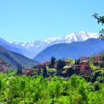
The Chefchaouen Mountains belong to the mountain range and are the destination of guided excursions. They are characterized by a rich flora, especially the forests of cork oak, green oak, endemic Moroccan fir and Atlas cedar.
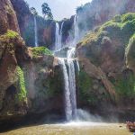
The Cascades of Akchour is a mountainous area with many waterfalls, located 29.2 km (18.1 mi) from Chefchaouen.